.png?w=auto&h=400)

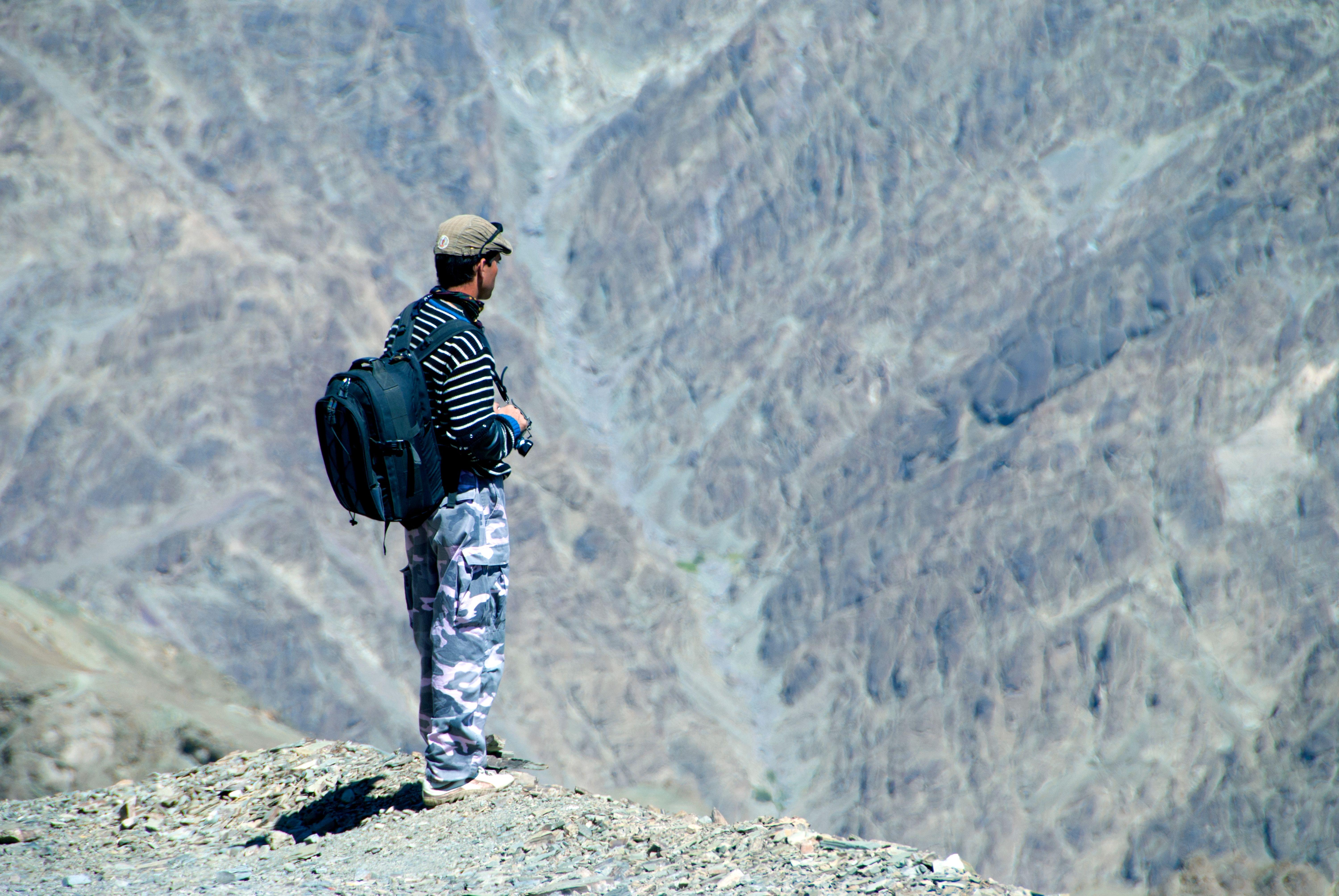
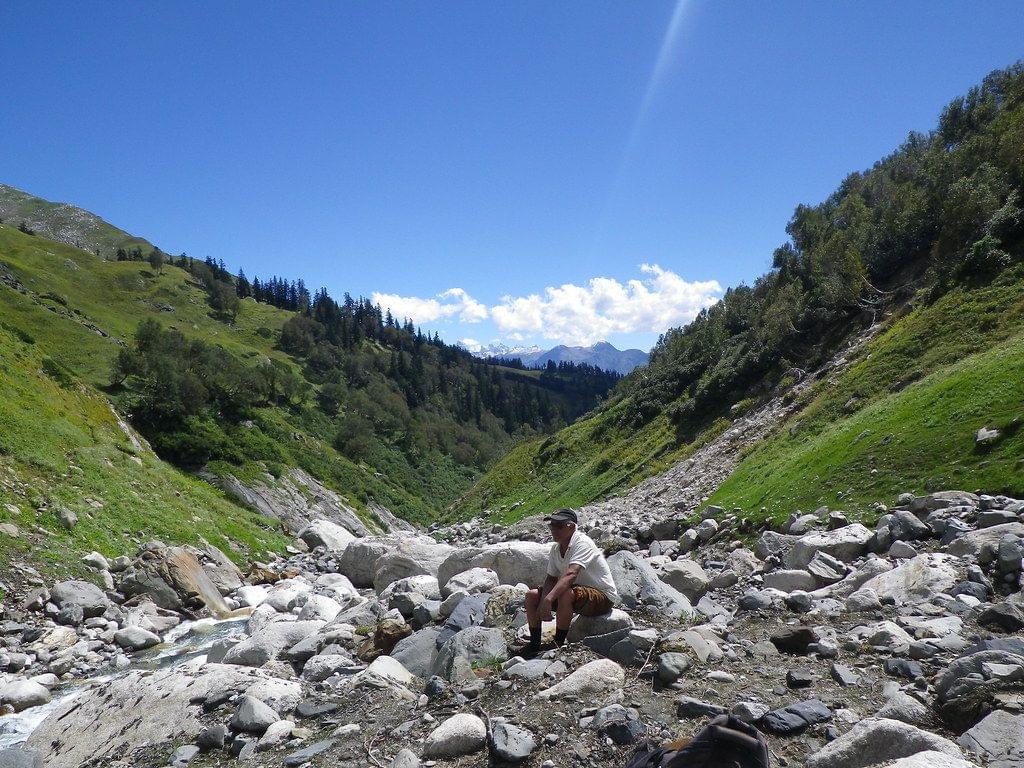
Parang La Trek Overview
Quick Facts of Parang La Trek

Maximum altitude reached during the trek- 18,300 feet
Duration- 9 days and 8 nights
Trekking distance- 127 km
Trail type- Difficult
Rail head- Jogindernagar railway station near Kasol
Airport- Bhuntar Airport near Kullu- Manali
Snow Season- Throughout the year except during the monsoon season.
Service available (months)- April to November
Base camp- Kaza, Himachal Pradesh
Best season- June to September
Region- The trek would begin at Kaza, where you’d reach by a car/taxi from Manali. The trek would take you up to the region of Spiti Valley, Dak Karzong, Korzok and Ladakh.
Who can participate- The minimum age required to embark on the thrilling trek is 10 years.
Parang La Trek Detailed Itinerary

You’d travel from Kaza to Ki and later further to Dumbla.
First, you’d arrive at Kaza and make yourself comfortable with higher altitudes and get acclimatised.
After a short stay at Kaza you’d move towards the small village of Kibber which is situated at a height of 14,000 feet and is listed amongst the highest human settlements in the world.
While in Kibber, go and explore the surroundings where you’d find the famous Ki Monastery, a 11th century Buddisht site and quite renowned for its beautiful architecture, wall paintings and images of Lord Buddha.
Afterwards, you’d commence the first phase of the Parang La trek to move towards Dumla.
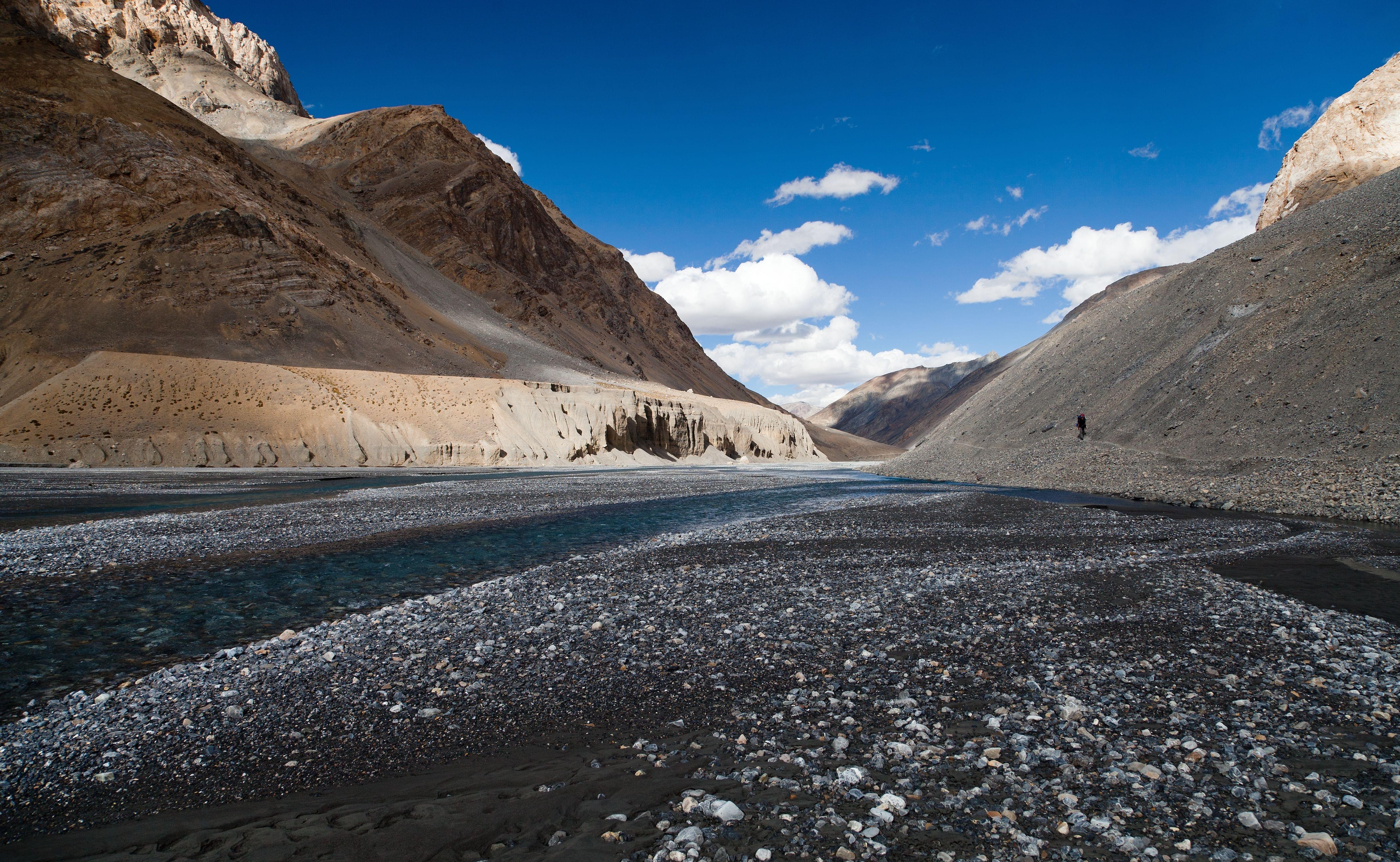
It would be a short hike through the rough terrain of the Lahaul and Spiti region. You’d pass through several deep and narrow gorges to finally reach the destination campsite of Dumla and plan an overnight stay there.

Get ready to get to an altitude of 14,990 feet approx, after a 3 to 4 hour long trek.
It would be a long trek through the mountainous slopes which would take you to the base portion of a narrow gorge.
After a short rest at the base of the narrow gorge, later in this phase of Parang La Trekking you’d climb towards the meadow of Thaltak.
On reaching the altitude, you’d pitch your tents and enjoy a peaceful camping.

After spending a night at Thaltak and enjoying a sumptuous breakfast, set yourself on a journey to Jagtha and later towards Bong Rozen.
The first phase of the Parang La Trek to Jagtha and Bong Rozen is a 8km long trek through the challenging paths.
The route would be full of obstacles like hordes of small and big rocks, and a river stream that you’d ultimately follow upwards to reach the destination.
On arriving at Bongrojen, go and take a short tour around the campsite where you’d stay overnight.

This phase of the trek would take you through the main stretches of Parang La and through the summit of the pass itself.
Brace yourself for a long day and start with a hot breakfast.
You’d ascend to an elevation of upto 18,290 feet at Parang La, and on reaching the summit have a good look of the bewitching views of Spiti Valley.
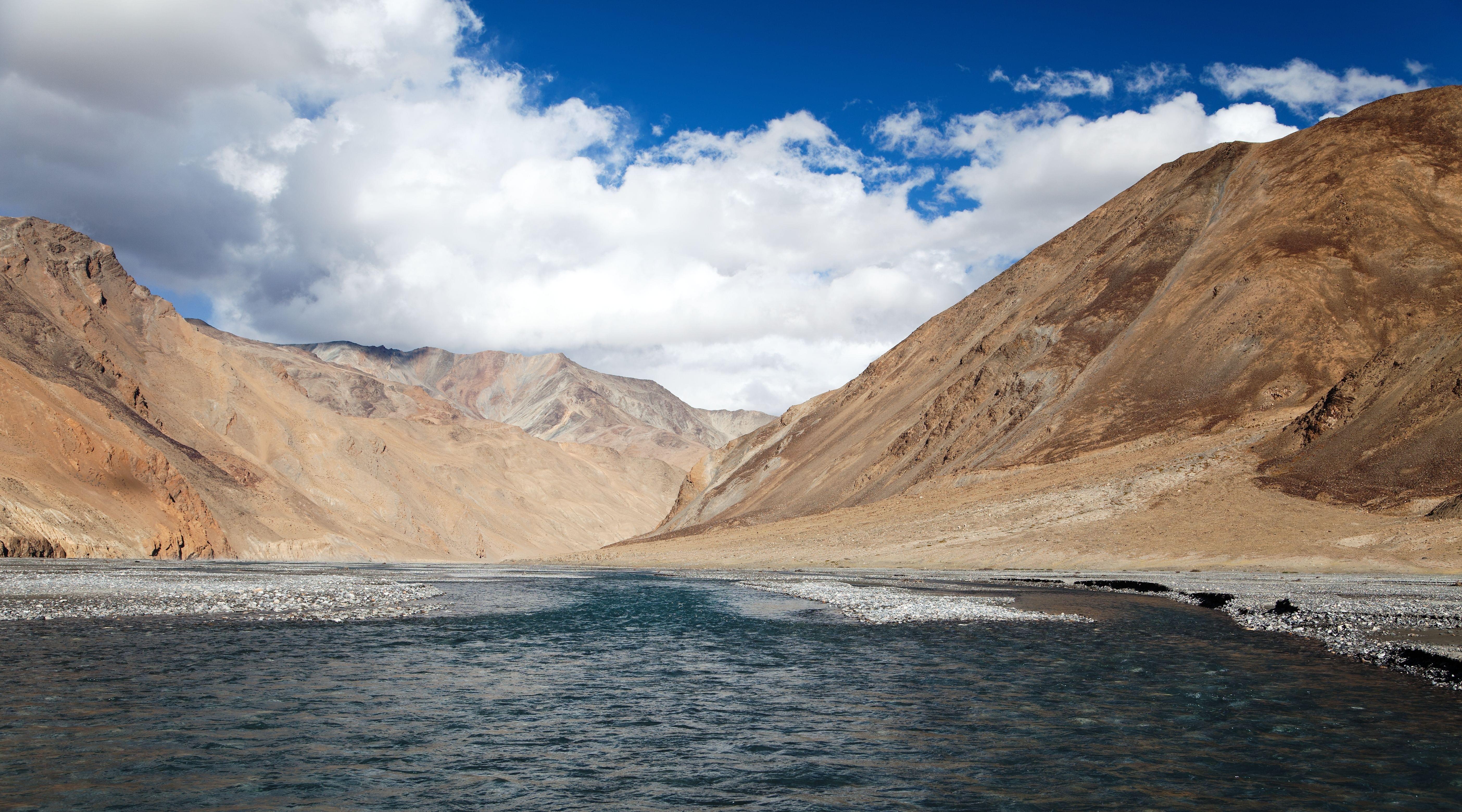
Later descend towards the Pare Chu River, after some steep and mountainous trails tread on the flat plains on your way back to Dak Karzong located at an altitude of 16,200 feet.
Karzong is a small, flat and barren valley with high mountains covering it all around. The beautiful and peaceful haven is where you’d camp for the day.

On the 5th day of the Parang La Trek, you’d head upstream with the Pare Chu River.
The trek would take you through the numerous mountain rivers, and finally land you at the Datang Yongma where you’d set up the camp and rest there the whole night.

During this phase of the Parang La Trekking itinerary you’d proceed to hike early morning after a hot breakfast along the flat trail passing through the Racholamo Valley.
After passing the valley the route goes downhill considerably, taking you through the grounds of Norbu Sumdo.
To go beyond Norbu Sumdo you’d cross a river and set yourself on the way to Chumik Shilde.
You’d reach the destination of Chumik Shilde which is located at an altitude of 14869 feet after a trek of 5 to 6 hours. Here, the camp would be prepared for you.

On this day of the Parang La Trek, you’d witness the most beautiful scenery on your way from Chumik Shilde to Tso Moriri.
The trail would be comparatively simpler as well as it would be flat and vast plains.
On successful completion of the trek you’d finally reach Tso Moriri, a glacial lake located at an altitude of 15,075 feet.
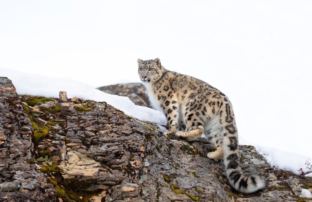
Around the lake you might see other Himalayan animals like Tibetan wild asses and hordes of migratory birds.
After enjoying the beautiful sight of the lake you’d be transferred back to the campsite.

Slowly descend from the Tso Moriri to Korzok while walking along the shores.
Korzok village, which is located at an altitude of 14850 feet is the perfect spot to click pictures of the snow-clad peaks of the Ladakh Mountain ranges.
At the village you can even pay a visit to the Korzok Monastery which has very marvellous intricate wall paintings of numerous Buddhist deities.
After the long 6-7 hours long trek, you’ll be transferred to your campsite.

You’d travel from Korzok to Leh by road to finally conclude the Parang La Trek .
Afterwards you can either choose to explore the town or travel further to Srinagar or Manali and board a flight to Delhi.
What to Pack for Parang La Trek

Essentials
The preparations for an outing in the mountains have to start with finding a suitable pair of trekking shoes and a backpack with a capacity of 50-60 litres with good hip and shoulder support.
You should also add a head torchlight and rainwear in your itinerary to tackle the constant weather changes. The daypack you carry must be stuffed with water bottles, rainwear and emergency medicines.
Keep a walking stick along for trekking through the steep trails.
Pack dry snacks like energy bars, dry fruits to keep your energy levels up and an electral/ORS for hydration purposes.
The other must-have items are- suncap to protect yourself from the sun’s harsh rays during the day, Hand gloves while handling snow, a woollen cap to keep yourself warm, at least 3 to 4 pairs of socks for cushioning and warmth especially for the extremely cold nights.
You must pack extra clothes, choose synthetic clothes over cotton shirts/tops and it's advisable to keep a pair of thermal inner clothes if you’re prone to cold. Choose a padded jacket as your outer layer, make sure it has a hood as well.
Keep one or two extra pairs of trekking pants for minimum, pants with zip-off thighs and quick drying would be ideal for treks.

Additional Essentials
Keep a light toilet kit with you consisting of a toothbrush, a roll on deodorant, moisturiser for skin, lip balm toilet roll and toothpaste. Make sure that you carry miniature size products and don’t overload on shampoos or soaps as you won’t be able to take a bath on the trek.
A personal medical kit is advisable to be carried by the trekkers, it should contain the most readily available medicines like Dolo 650 mg, Avomine, Combiflam, Digene, ORS, Knee brace. Take advice from your trek leader before taking any medicines.
Don’t forget to put essential documents- original photo identity card like aadhar, voter id, etc. At the trek all foreign nationals are required to share their passport and visa details during registration as well as upon arrival.
Know before you go to Parang La Trek

It is advisable to the trekkers to not bring any non-biodegradable material along and contribute to sustainable tourism.
While covering the challenging and long Parang La trek distance, all the participants must follow the instructions of the trek leader and guide for their own safety.
Keep some buffer days in hand to acclimate yourself to the higher altitudinal weather conditions of the trek through Manali.
All the trekkers are required to carry enough money at hand because you won’t find ATMs during your trek through the remote villages at higher altitudes.
Tea is a warm beverage and is usually consumed in hilly areas, but it gets very expensive on moving upwards. Therefore, you are suggested to carry tea bags to use during the trek.
Pack an efficient daypack with all the essentials like warm clothes, sunglasses, trekking boots, gloves, socks, woollen caps, medicines, rainwear, water bottles and other essentials.
The weather conditions are the most unpredictable on the mountains, on a sunny day it can be very sweaty to follow trails and soon the clouds might get heavy to pour down. Therefore, embrace yourself for frequent weather changes and don clothes accordingly.
Take a note that sunburn at higher altitude might happen quicker, so keep your skin and eyes safe with moisturiser and sunglasses.
Keep extra batteries for torches and other electronics handy as the batteries in cold might die quicker than at home.
Don’t forget to carry water bottles along and keep yourself hydrated throughout the trek.

The adventurous journey at the Parang La Trek would begin at Kaza in Spiti Valley, Himachal Pradesh. Therefore, all the interested mountaineers are required to reach Kaza.
By Air: You can book direct flights to Bhuntar Airport, Kullu from Delhi, Mumbai, Kolkata and Bangalore. Kaza is located 250 km away from the airport, you can take a taxi or bus to cover the distance.
By Road: There is a direct route via Delhi ( 740 km) via NH 44, Chandigarh (482 km) via NH3, Ambala (514km) via NH505 and Dhedradun (632 km) via NH505. You can drive upto destination by yourself or can catch a bus which runs regularly to Manali from the mentioned cities and for further journeys to Kaza catch a taxi or bus.
By Train: Jogindernagar railway station near Kasol is the nearest railway station to Kaza. The Town of Kaza, is further 350 kms aways from the railway station you can take a taxi or bus for the journey further.

The best time to plan Parang La Trek is during the months between July to September. It’s the time when the Parang La summit is snow-clad, and the challenging trek which passes through the beautiful villages make it a great experience for snow-lovers and mountaineers. The Parang La Trekking during the months of April-May and September-November is recommended since the weather is pleasant and clear, making it convenient for trekking and enjoying the bloom of flowers in the meadows. Between June to August, at the summit along with greenery and snow you’d experience rainfalls/ snowfalls which would make the steep and rocky paths even more challenging to cover. During the winter season of December to February it gets highly risky to plan a trek as the routes are covered with 6 inch deep snow. During the recommended months for the visit between April to November the temperature between day and night varies greatly. During the day, temperature might shoot up to 5 degree Celsius to 10 degree while dropping to -1 degree to -2 degrees at night.

- Kaza to Dumla- Arrive at Kaza in Spiti Valley which is the beginning point of the Parang La trek and trek a good distance of 18 km in 4 hours to Ki and further to Dumbla.
- Dumla to Thaltak Meadow- Continue your trekking from Dumbla to Thaltak Meadow and stay there overnight, enjoying a peaceful campsite.
- Thaltak Meadow to Bongrojen via Jagtha- Passing through the beautiful Thaltak Meadow trek for a good long time of 7 hours and arrive Bongrojen located at an altitude of 16,780 while passing through Jaghta.
- Bongrojen to Dak Karzong via Parang La - Finally, mark your journey through the Parang La mountain pass. From the elevation of 18,290 feet, enjoy the views of Spiti Valley and descend along Pare Chu River to Dak Karzong.
- Dak Karzong to Datang Yongma- Move to Datang Yongma with a 5 hour long trek following the passage along the Pare Chu River.
- Datang Youngma to Chumik Shilde- Proceeding from Datang Yongma trek upto Chumik Shilde which is located at a height of 14,869 feets above sea level.
- Chumik Shilde to Tso Moriri - The glacier lake of Tso Moriri is a 5 hour long trek further from the Chumik Shilde.
- Tso Moriri to Korzok - Enjoy the snow-clad mountains of Ladakh as you move from Tso Moriri to Korzok.
- Korzok to Leh - Finally, call the journey at Parang La Summit at an end and move to Leh from where you can either continue your expedition journey or return to your native place.
Why to visit Parang La Trek ?
You May Also Book
FAQ's
How Difficult is the Parang La Trek?
Parang La Trek is amongst the most challenging and difficult treks in India covering a lot of destinations and long journeys at a higher altitude. The trail of the trek passes through the beautiful Dumla, and the lake of Tso-Moriri while passing through the Parang La summit which is located at a height of 18,600 feet. The passage is diverse, sometimes quite steep but other times a smooth flat terrain, therefore the trekker won’t require any expertise and past experiences in trekking for joining in. You would be walking 5 to 6 hours on an average per day for upto 8 days to finally cover the long Parang La Trek distance successfully. Therefore, it’s advisable to add a good exercise schedule in your daily routine as well, to keep yourself in physically good shape to not face any problem during the trek like cramps and fatigue. The basics like walking, jogging, squats and stair climbing would be sufficient though you may add other exercises as per your bodily requirements. Try to be consistent with the exercise schedule and keep repeating the exercises for longer duration.
What is the network connectivity on the Parang La trek?
Once you cross the Rohtang pass, on your journey to Kaza from Manali, the signals get weaker, almost negligible. However, all postpaid or prepaid connections (J&K) work in Leh. You may take the BSNL connection, which is available at certain spots during the trek.
What is the minimum and maximum age limit?
The minimum age limit is about 13 years in age, and minors between the age group of 13 to 17 should be accompanied by an adult. Moreover, trekkers above the age of 60 are required to produce a medical certificate to qualify for the trek.
Treks in Himachal
Treks in Uttarakhand
Treks in Nepal
Treks in Kashmir