.png?w=auto&h=400)

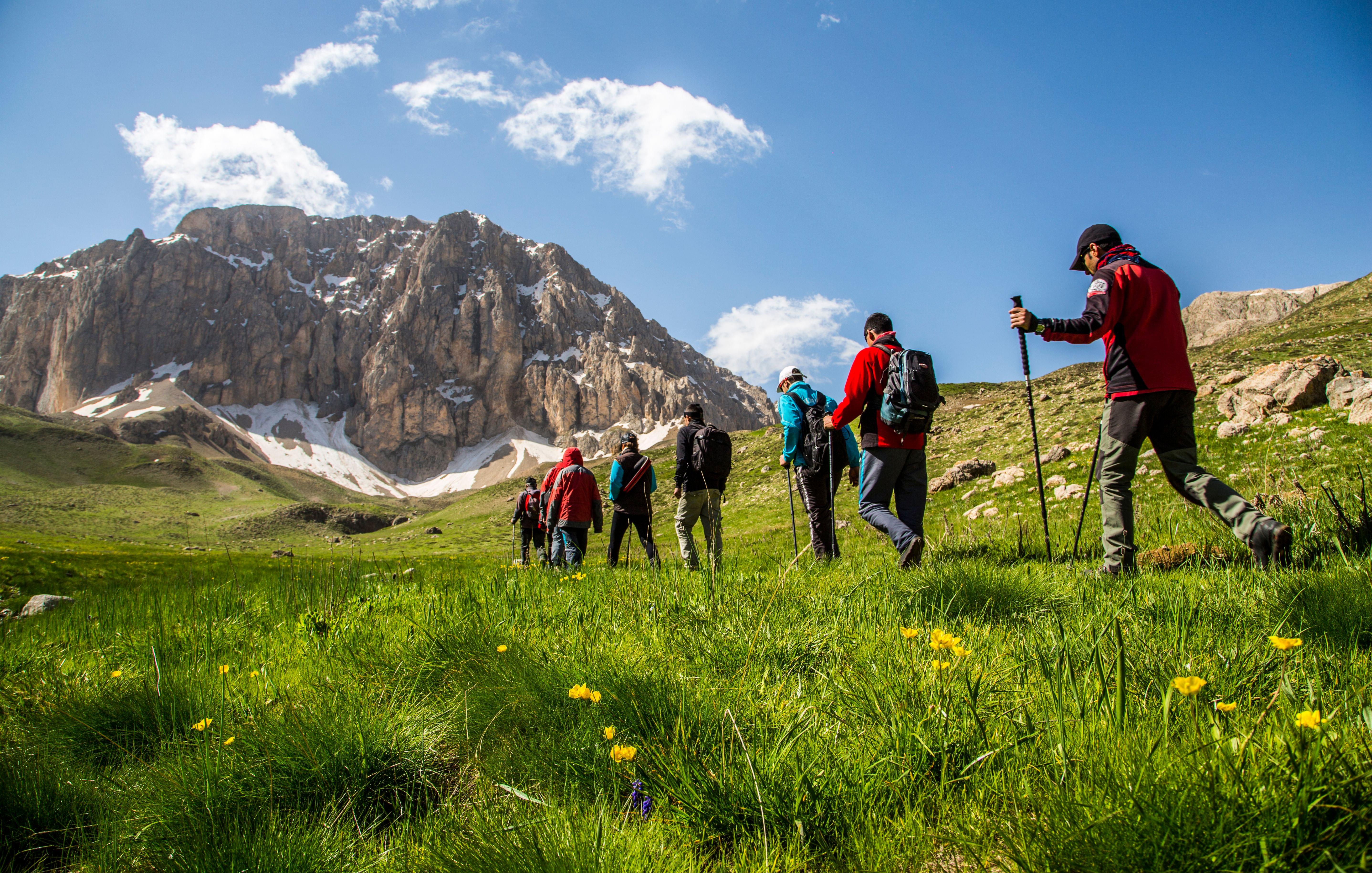
Rudranath Trek Overview

Quick Facts of Rudranath Trek

Duration - 7 Days/ 6 Nights
Trail type - Steep ascent and descent
Maximum altitude - 11,811 ft.
Snow Season - November to March
Best season - May to October
Grade - Moderate
Trekking distance - 62 kms
Region - Uttarakhand
Rail head - Rishikesh's railway station is the closest one to the city.
Airport - Jolly Grant Airport in Dehradun is the closest airport.
Short Itinerary for Rudranath Trek
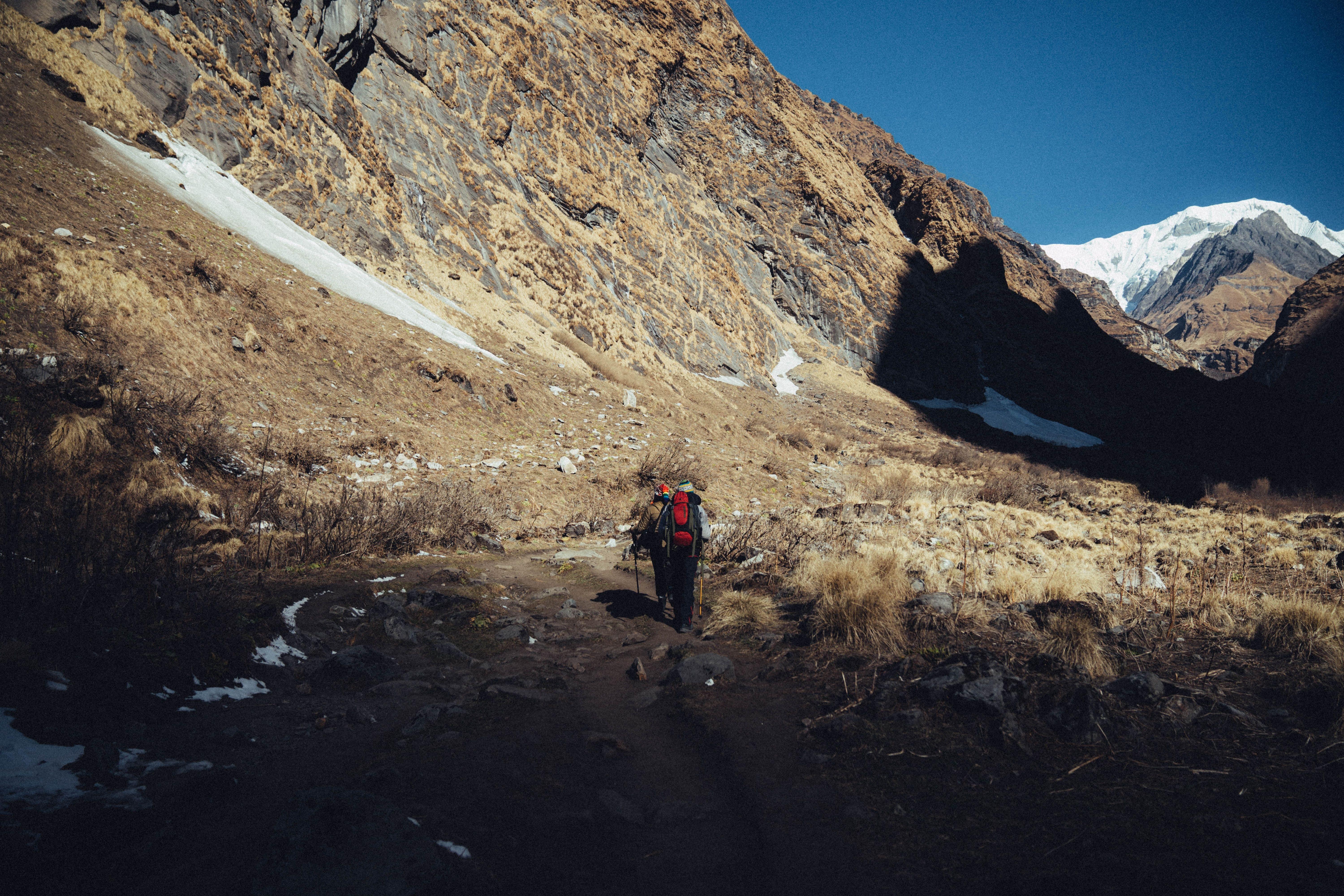
Rudranath Trek Detailed Itinerary

Reaching Devgram from Helang via Rishikesh
Height: 6,627 feet
Duration: 10–12 hours of driving; a 30-minute hike
Travel 8 to 9 hours from Rishikesh to Helang and take a rented jeep from Helang to reach Devgram in the Urgam district.
You should be able to go to Devgram in around an hour. The final 2 miles must be hiked.
The initial path is a dirt track through lush valleys that is stone paved. As you get closer to the settlement, the trail turns into a paved road.
You will pass a fresh water tap that appears like a cow's mouth along the route. The water runs through here all day long.
You can view the stunning Alaknanda & Kalpganga river confluence not far from Helang.

Trek to Kalpeshwar and back
Height: 7,217 feet
Duration: 2 to 3 hours
Begin your tour to Kalpeshwar from Devgram, close to Prathik Lodge. The walk begins by ascending a concreted path that passes through towns and farmland.
In around 15 minutes, you'll traverse through lush green valleys. As you go, stay towards the left of a river and you may find a waterfall in the distance up ahead in 5–10 minutes.
At this point, the roadway becomes level. Trek over lush meadows in the Kalpganga valley that are clearly visible to the right.
You will approach a suspension bridge in the next 5 minutes. Once you have crossed the bridge, you will see the stairs leading up to the Kalpeshwar temple.
Follow the same route back to reach Devgram.

Trek to Bansi Narayan from Devgram
Altitude: 6,667 feet to 11,482 feet
Duration: 8 to 10 hours, 12 kilometers
Start your day 3 with a hearty breakfast and keep lunch as you won't be able to locate anywhere to buy food along the journey.
Take the route leading left from Prathik Lodge and trek through terraced fields where locals cultivate potatoes and rajma (kidney beans).
Reach the water wheel after a further 10-15 minutes of trekking and follow the trail of this water for 40 to 45 minutes. Following the trail will drop you to the Bansa village where you can see the beautiful Urvashi temple.
As you take the hike after leaving the temple, a bridge will soon be seen. Take the ascending trail that you get after crossing the bridge.
Stay to the left of the stream and keep walking.
On the right hand side of the ridge, after about 40 minutes of trekking, comes a modest stone temple. Continue your trail ahead into the dense woodland.
A few boulders will appear on the left end of the route after 45 to 50 minutes. You can have your lunch here.
As you ascend, you arrive at the Bansi Narayan temple in a short while. It requires around 7 to 8 hours to get here from the initial point of the trek of day 3.
Beyond the temple, you have to head to the natural caves where you can stay for the night as it has the capacity to accommodate 30 - 40 people.
The path to the cave passes over several enormous stones which takes around 25 to 30 minutes to gradually ascend.
Rest at the caves from where you can see the snow-covered Himalayan peaks Nanda Devi, Trishul, Dronagiri, and Nandaghunti.

Trek from Bansi Narayan to Dumak
Altitude: 11,482 feet to 7,874 feet
Duration: 5 to 6 hours covering 10 kilometers
Wake up to the views of a cave with amazing vistas of vibrant wild flowers scattered across lush green fields with beautiful Himalayan peaks directly in front.
Retrace your steps to the Bansi Narayan temple. The route turns to the hill to the right after you pass the temple. In five to ten minutes, you'll reach the deep woodland.
Stick to the right side of the valley as you continue down the muddy route. This stroll amid overgrowth and thickets filled with vibrant wildflowers is moderate downhill.
After 10 minutes, you will find one water stream where you can refill your water bottles. Further in your trail, you will encounter a few fallen trees and some boulders after which the descent becomes steeper.
The Alaknanda valley spreads out ahead after 45 to 50 minutes where you will locate Kalgoat settlement, a place that you can use to rest.
Dumak and Kalgoat are located around 7 kilometers apart. From the hamlet of Kalgoat to Dumak town, a two to three-hour journey along a clearly designated path is required. The path should be followed as it passes through plants and big stones.
A 20–30 minute stroll through the hamlet will bring you to an ancient stone Mahadev temple. The Dumak side of the hamlet is where this temple is located.
Continue trekking down the path that winds among the trees and bushes. After about an hour, the settlement of Dumak can be seen in the distance.
In around 40 minutes, you will arrive at a pre-primary school with a blue sign.
Either camp along the creek a bit ahead or stay at the guest house, which is approximately five minutes up the route.

Trek from Dumak to Panar via Toli
Altitude: 7,874 feet to 11,155 feet, via 9,186 feet
Time: 6 to 8 hours to cover 12 kilometers
Start your trek early on day 5 and take the paved path that leaves Dumak village just on the opposite side. You will arrive at the ridge's end in about 25 minutes.
Take the trail that goes to the right where you will find severe descent along a muddy and narrow path. Stay on the valley's right side and keep walking for another 40 minutes and witness the Rudra Ganga river.
Cross the river and move towards right into the woods. In about 45 minutes, you will reach the end of the ridge, and enter the huge meadows of Toli.
Find yourself surrounded by gorgeous alpine lakes and vast green pastures at Toli, which is encircled by a dense forest.
The route gets a little more difficult after Toli as there are not many notable sites. Follow the route as it curves to the right and gradually ascends up the ridge. In 30 to 40 minutes, you practically reach the summit of the ridge.
Continue to ascend to the left until the rise gets steeper. You observe the greenery thinning after 45 to 50 minutes. When you reach the summit of the ridge, keep travelling along this route. From here, the trail contours the mountain to the right and leads to the Panar's slope meadows (11,155).
Stay in the tourist hut or a shepherd settlement nearby.

Trek to Rudranath from Panar
Altitude: 11,155 to 11,811 feet above sea level
Time: 6 to 8 hours to cover 12 kilometers
Begin the following morning after breakfast. Take the left-pointing route that leads to the ridge. To your left, there are several sizable stones and snow-covered summits.
The trail ascends the hill gently and after 25 to 30 minutes of climbing, you can glimpse the Panar fields below. After another 30 to 40 minutes of trekking, you come to a large overhanging rock on the left . Take in the breathtaking view from here, with the broad, lush Panar meadows below and the snow-capped summits in front, shrouded in clouds.
Continue on the ridge-climbing track and soon you will come to a section with large stones on each side of the route. After which the trails are well defined so your journey further will be smooth.
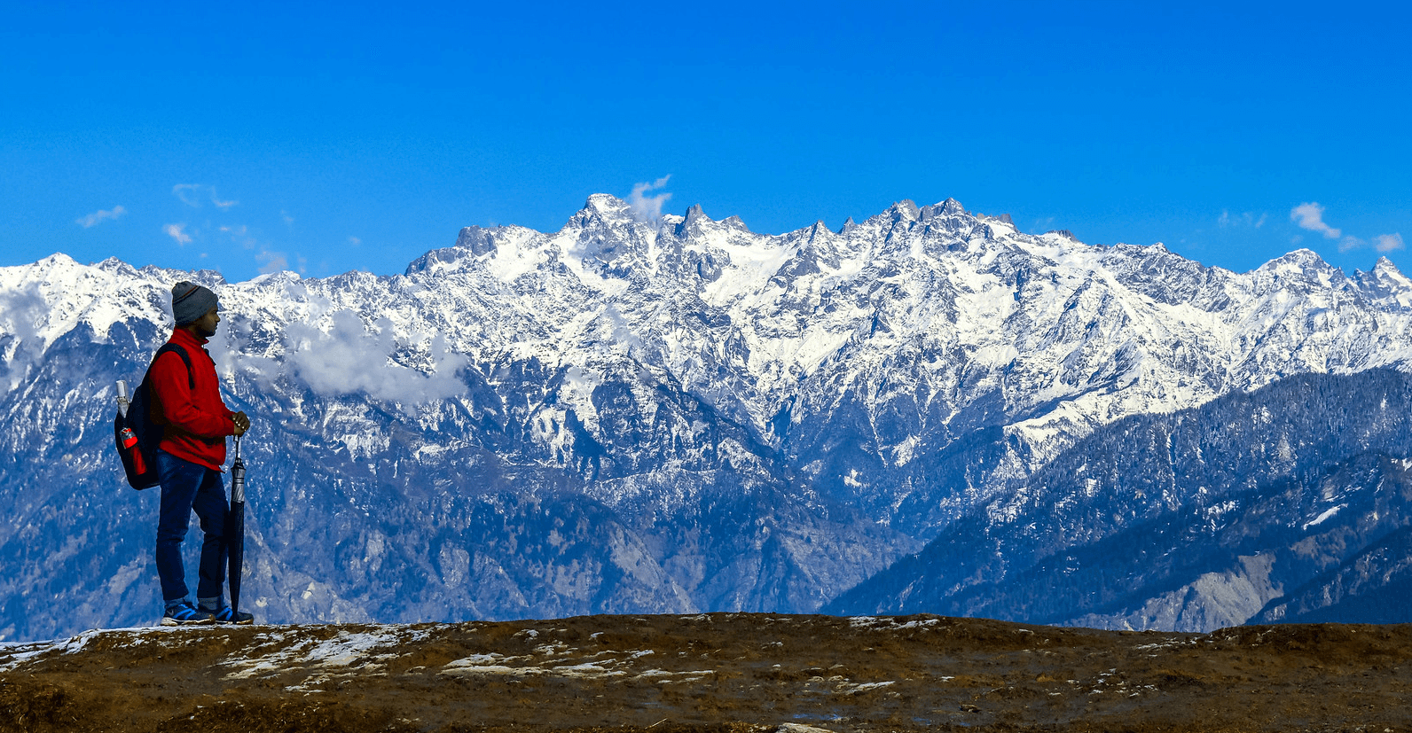
Marvel at the vistas of the Himalayas from this hilltop between Panar & Rudranath as you find yourself surrounded by snow-capped mountains and emerald valleys on all sides.
Rudranath is connected to Mandal Forest & Anusuya Temple by a short ridge on the left. The Mandal forest is traversed by this lovely route.
Keep the river to your left as you continue up the ascending dirt route. Flags and prayer bells will soon be visible in the distance. It takes around 15 to 20 minutes to get there.
On this path, this represents the highest mountain. From Panar, it requires 3-3.5 hours to get here.
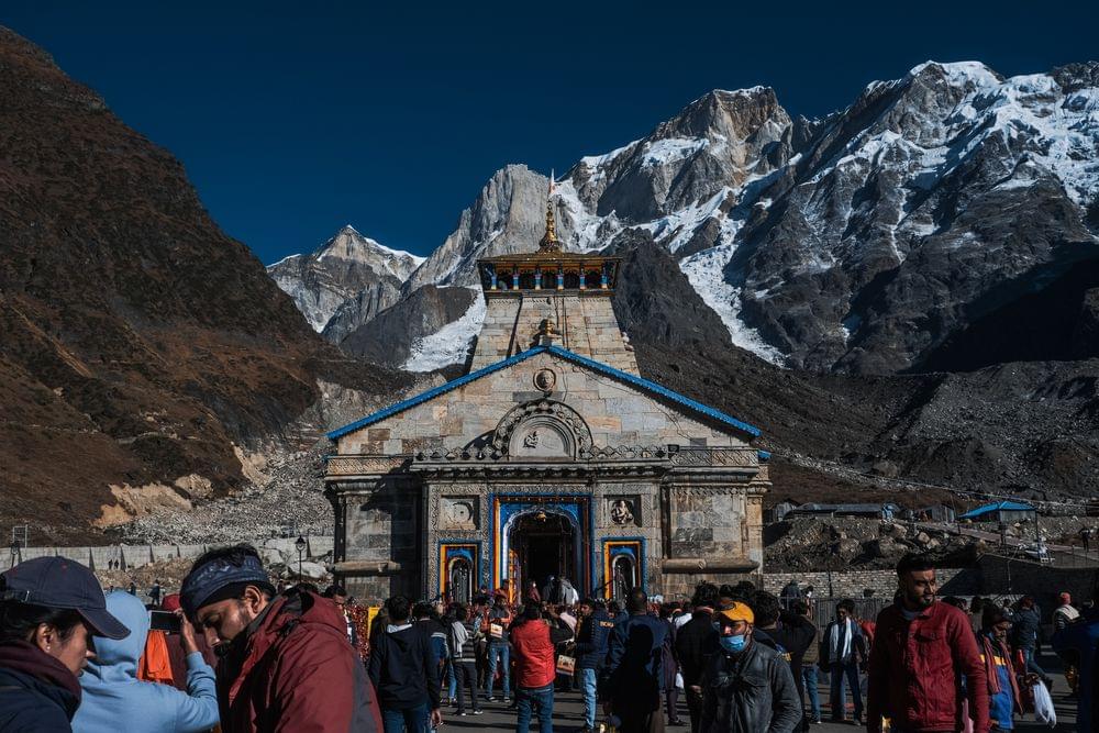
After an hour-long climb, the Rudranath shrine can be seen from a distance. Prior to ascending, the route falls.

Trek from Panar to Sagar
Altitude: 11,155 to 6,561 ft
Time taken: 4-5 hours to cover 12 km
Begin your last day of trek with a hearty breakfast. From Panar, follow the rocky, muddy route that descends to the left. In about 30 minutes, you will reach Lunti Bugyal's grasslands.
Continue your trek on the route that heads in the direction of your left from Lunti Bugyal. In 15 to 20 minutes, the route reaches a deep woodland. Continuing on the muddy trail for 45 minutes will drop you at a water stream. Take the cement bridge across it and trek through the woods.
After 25 to 30 minutes, a lovely meadow is visible in the distance and to reach there, you are required to hike another fifteen minutes.
The area is surrounded by forests on all sides where you can find a few tea and food stalls.
The route from the meadow continues into another woodland. Terraced fields may be seen to your left once the woodland has cleared for 30 to 45 minutes.
Follow the clearly marked track and trek through the fields. A brook will slowly appear as you move forward. From the point you reach near brook, the route narrows and goes through rocky stairs as it leads to Sagar village.
At the bottom of the stairs leading to the trail is the bus stop. Sagar village is on the Mandal-Gopeshwar route, and from here you may take a shared jeep or bus to Gopeshwar.
One can travel towards Chamoli village from Gopeshwar and catch a bus that goes to Haridwar & Rishikesh. After reaching Haridwar or Rishikesh, you are free to go to any location of your choice.
What to Pack for Rudranath Trek?

Trekking boots: Because the hike would require you to walk for extended distances, you should have suitable trekking boots.
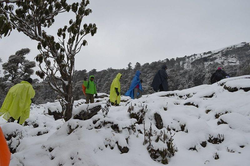
Backpack - A backpack with detachable straps and a strong structure with rain cover is necessary. Carry a poncho with you in case you encounter pre-monsoon rains or unexpected post-monsoon rain during your Kalpeshwar Rudranath Trek.
Clothing - You'll be climbing & camping at high elevations, so bring three warm layers (five in winter). So ensure you are dressed appropriately for the weather. Make sure you dress warmly because the upper elevations will be freezing.
Trekking Pants - One pair of trekking pants should be plenty for this hike. In the event that the first pair gets wet, you can bring a replacement pair along. One pair to carry and one pair to wear. Carry two collared t-shirts so you can avoid getting sunburns on your neck and arms. Once more, carry one and wear one.
Thermals: People who are more vulnerable to the cold should have thermal clothing with them at all times.
Sunglasses: Sunglasses are used to avoid becoming snowblind which you might need in Har Ki Dun Valley or Kalkatiyadhaar.
Know Before You Go to Rudranath Trek

Before you actually begin your journey, it is a good idea to inquire with local officials, tour guides, or travel agencies about the road and weather conditions during monsoon season.
It is generally beneficial to have a knowledgeable trek guide with you since they will be familiar with the terrain and ensure that hikers don't get lost or become trapped.
Electronics should be stored in waterproof bags to keep them dry.
Lemon & salt or an electrolyte drink (Gatorade, Electrical, Glucon D) should be consumed when facing dehydration or loose motion.
Keep tracking boots, paint, a quick-dry shirt, and a cape.
Keep a whistle for emergencies.
Due to the significant snowfall, the temple remains shut from November to April.
Scissors, sunscreen (SPF 50+), bandages (waterproof), painkiller spray (Relispray, Volini), antiseptic liquid (Sevlon, Dettol), antiseptic powder (povidone-iodine-based powders like Cipladine, Savlon), bandage, cotton, crepe bandage, etc. are all included in a first aid kit.
Medications: for acidity, acid reflux, motion sickness, headache, and fever.
Before beginning the Rudranath trek, one must be aware of the weather.
You can go on a mountain hike with a local guide if you don't have any prior expertise.

By Air: Jolly Grant Airport in Dehradun is the closest airport, while Rishikesh is the closest railhead. The starting point for a trip to Rudranath may be Sagar. You must hike 22 kilometres to reach Rudranath.
By Bus: Regular buses run along this route, and the travel time between Rudraprayag to Helang is around 5 hours. One may also hire a cab, which would take around three and a half hours.
By Car: There are direct roads from Delhi to Rishikesh. Trekkers must reserve a bus or a private taxi. There are several websites where you can quickly make reservations for cabs and buses.
By Train: Rishikesh's railway station is the closest one to the city. Trekkers can choose a direct path or one that goes through Delhi because Rishikesh is linked to all significant train lines. They can also choose to take immediate trains towards Dehradun or Haridwar, where they can then take a bus or taxi to go to Rishikesh.

Covering Rudranath trek distance is among the difficult adventures that worshippers and explorers might do to get to the shrine. Depending on your tastes and how you want to explore the area, you may pick the trek path. The pastoral and clean environs of the area are evident throughout the path to the temple. The three ways to hike to the temple are as follows:
Route 1: Sagar village, which is 5 kilometres from Gopeshwar, may be reached by cab or bus. Beyond there, a 20-kilometer hike must be taken to go to Rudranath. You need to exercise caution because the route is slick.
Route 2: Another choice is to hike 17 kilometres uphill from Gangolgaon, which is located little over 3 kms away from Gopeshwar. You will pass through shepherd settlements for Panar and Naila on this trip through the forests.
Route 3: The route travels 21 kilometres from Gopeshwar towards Rudranath through Mandal, where it passes the Anusuya Devi shrine.

The best time to take the Rudranath Trek would be between the months of May through October.
The Rudranath Temple's seasonal information is as follows:
Summers (April to August): Due to the region's temperate climate, the weather remains pleasant. It is good to schedule excursions such as tourism, temple visits, as well as other outings because the average temperature is approximately 15°C.
Monsoon season (September to November): The area receives insufficient rainfall, yet the journey might be treacherous. Plan a trip around this period if you want to take in some local activities and enjoy the beautiful green surroundings while living in a homestay.
Winters (December to March): You should prepare for severe weather since days are frigid and the average low drops to 4°C. Sub-zero temperatures are possible at the minimum.
General Trivia About the Rudranath Trek

The mythology of PanchKedar is an intriguing account of the Pandavas' attempts to atone for their fratricide (gotra-hatya) crime of killing their siblings, the Kauravas, and Brhmanahatya (killing of Brahmins, the priest class), which occurred during the epic Mahabharata conflict.
On guidance from gurus and their beloved benefactor deity Krishna they asked Lord Shiva to forgive them and enable them to gain salvation. Shiva wanted to get away from them since he was upset with them for their behavior during the Kurukshetra conflict. He converted himself into a bull or Nandi inside the Himalayan Garhwal area. But after spotting Shiva as a bull grazing in the hills of Guptakashi, the tenacious Pandavas sought to restrain the bull by force.
However, the tenacious Pandavas attempted to forcefully grab the bull with its tails and rear legs after spotting Shiva in the shape of the bull feeding in the foothills of Guptakashi. But the bull vanished beneath the earth, only to return later at five different locations as Lord Shiva. The five locations where Lord Shiva appeared was at Kedarnath, Tungnath, Rudranath, Madhyamaheshwar, and Kalpeshwar. When Lord Shiva appeared in five distinct locations, the Pandavas were delighted. They erected temples at each location, worshiped Shiva, and received his blessings to find redemption. Later, AdiSankaracharya found the temples
Why to Go for Rudranath Trek?
You May Also Book
FAQs of Rudranath Trek
Has the Rudranath trek started yet?
The temple and its surroundings open in the middle of May and are open to visitors for the following six months, or until the middle of October. Avoid scheduling a trek between July and August during the rainy season since the hike might get slick.
Where is the Rudranath Temple located?
You may take a bus or a cab from Rishikesh to the entrance point at Sagar, which is roughly 219 miles away, to go to the Rudranath Temple, which is located on the Gopeshwar-Kedarnath Road. You must hike 20 kilometres to get to Rudranath trek from Sagar. The closest railhead is at Rishikesh, while the closest airport is Jolly Grant Airport in Dehradun.
How Difficult is the Rudranath trek?
The Rudranath Trek is a moderate grade trek with some steep ascent and descent. This trek will also require you to traverse through boulders and calls for a significant level of stamina. For any novice level trekkers, we strongly advise a good degree of physical fitness because the peak is rather high in height. Before beginning this walk, we urge hikers to psychologically and physically prepare themselves.
For preparing yourself for the trek, begin your jogging at a steady pace and gradually pick up the speed as you go. Before the walk begins, be sure you can jog 4 kilometres in 20 minutes.
Flexibility is another factor that will make your travel more comfortable. You may help yourself with this by frequently stretching your quadriceps, thighs, lower spine muscles, and shoulders.
Can you now go on the Rudranath trek?
Mid-May marks the opening of the temple, and it is open to visitors for the following six months, or until mid-October. Avoid scheduling a trip during the monsoon season since the walk can be treacherous from July to August.
Is the Rudranath Trek challenging?
Make sure you are arranging your trip with a tour expert as it is a difficult hike. To minimize last-minute headaches, it is advisable to make your travel arrangements in advance.
Treks in Ladakh & Kashmir