.png?w=auto&h=400)
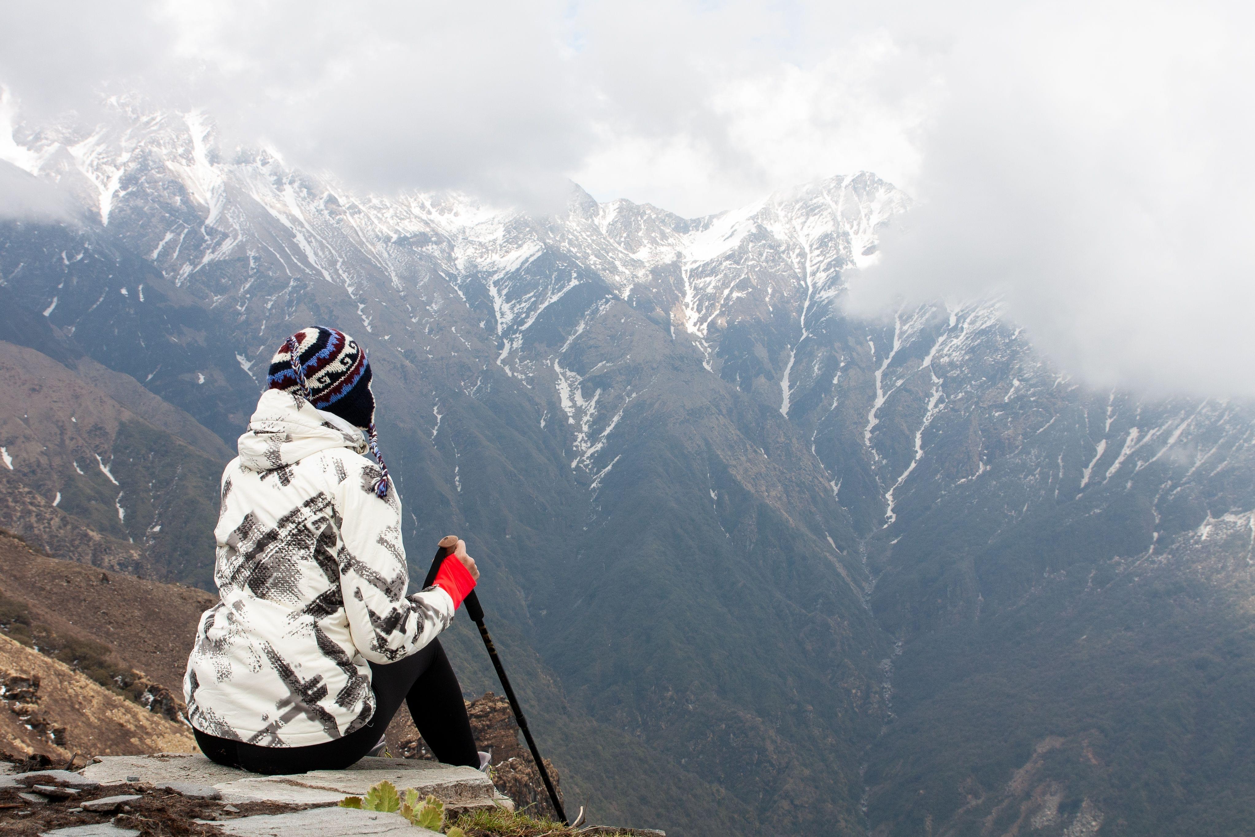
Chandratal Lake Trek Overview
Quick Facts of Chandratal Lake Trek

Maximum altitude - 14,100ft
Grade - Moderate
Duration - 5 days
Chandratal Lake Trek Distance - 35km
Rail head - Jogindernagar railway station
Airport - Kullu-Manali Airport in Bhuntar
Snow Season - Winters
Best Time for Chandratal Lake Trek - Summers
Region - Himachal Pradesh
Short Itinerary for Chandratal Lake Trek
Chandratal Lake Trek Detailed Itinerary

Manali – Jobra (Drive) and Trek from Jobra to Chika
Max Altitude - 10,100 ft
Have a scrumptious breakfast in Manali and transfer to Jobra- the base camp, the origin of Chandratal lake.
Receive guidelines and instructions from your trek leader at Jobra, and trek the easy 2-kilometer trail to reach Chika at an altitude of 10,400 ft.
Ascend through forests of green maple, pines, and birch trees.
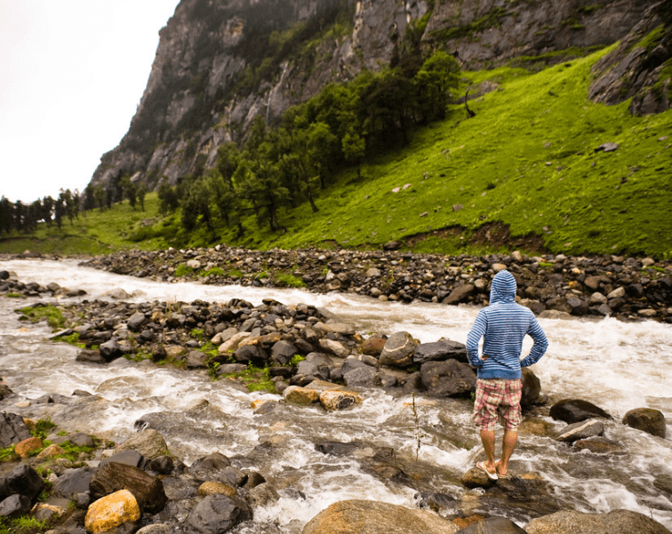
Halt Chika campsite near the banks of the Rani Nallah.
Witness River Rani reflecting the big rocky hills of Himachal.
Stay overnight at the campsite in the tents to freshen up.

Chika (10,100ft) – Balu ka Ghera (11,900ft)
Max Altitude - 11900 ft
Leave the Chika campsite behind and start an easy trek day as you enjoy amazing scenery.
Experience the enchanting views of the Dhauladhar ranges.
Witness the ‘White Range’ where mountains fill the entire view, dotted with hidden meadows and flowers.
Reach Balu ka Ghera at an altitude of 11,900 ft after trekking for 5 hours.
Have lunch and spend the rest of the day exploring and enjoying the campsite.

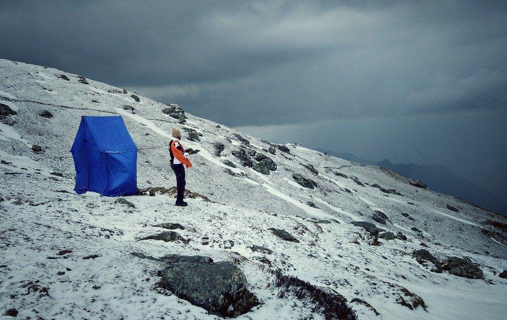
Balu ka Gera (11,900ft) – Siaguru (12,900ft) and crossing Hampta Pass (14,100ft)
Max Altitude - 14100 ft
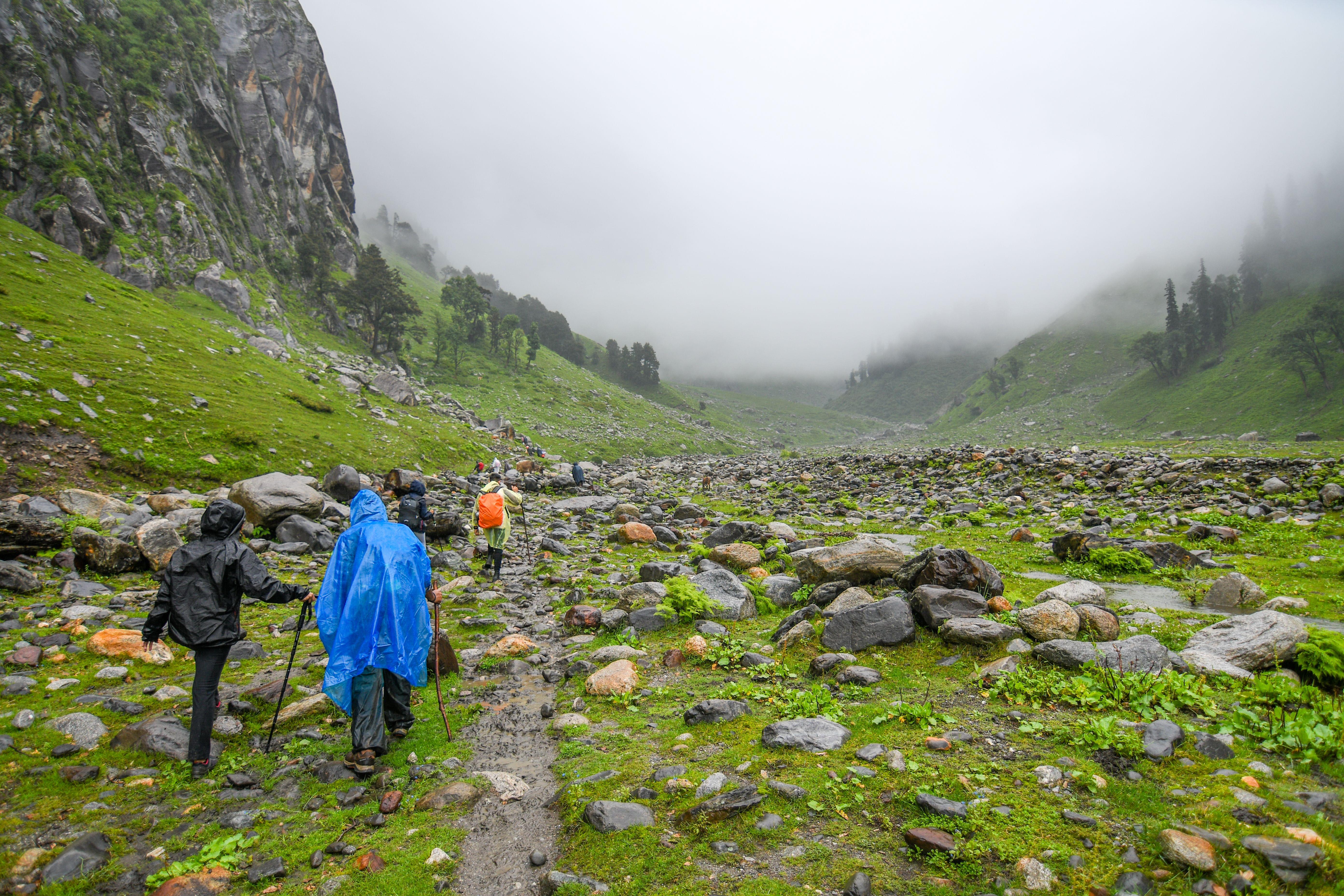
Get ready for the moderate trek for the day. Ascend the barren landscape of the Himalayas in Lahaul and Spiti Valley.
Experience steep climbs and reach Hampta Pass where you will witness the enchanting views of the green world from the top.
While you feel the bliss around the valley, you might encounter shepherds of the mountains nurturing their sheep with special green grass.
Start heading towards the next campsite but first take a halt at Hampta Village and get to know its local hill culture.
Descend to base camp in Siaguru at an altitude of 12,900 ft.

Siaguru (12,900ft) to Chatru (11,000ft) and drive to Chandratal lake
Max Altitude - 14100 ft
Wake up early in the morning and start trekking after having breakfast.
Descend to Chatru at 11,000 ft and witness Pir Panjal Mountain Range ahead.
Arrive at base camp Chatru.
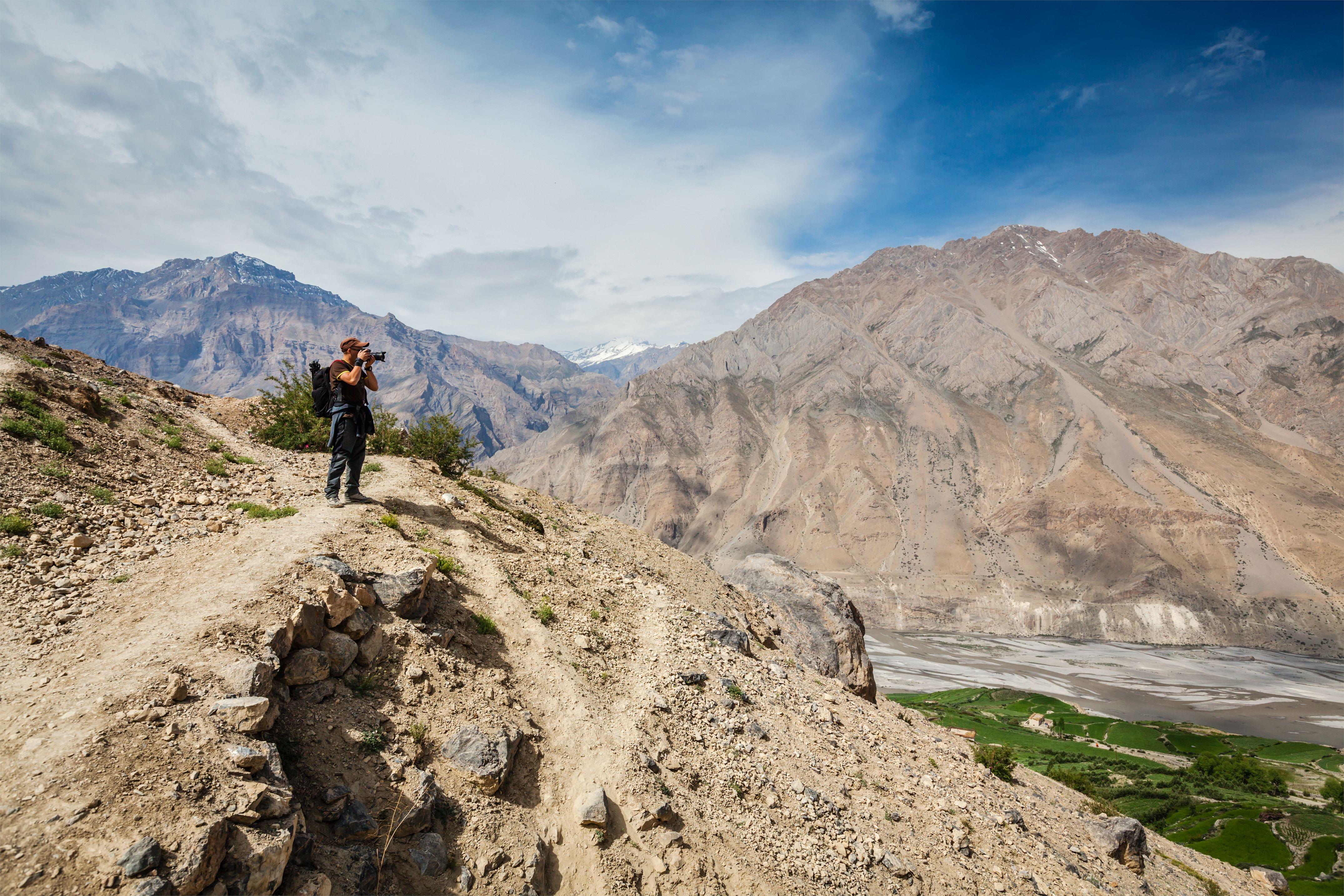
Experience the stunning views of the cold desert of Spiti Valley.
Arrive at Chatru to witness the confluence of three paths Hampta Pass, Spiti, and Rohtang Pass.
Enjoy the fresh breath of air on this green paradise amidst cold barren deserts.
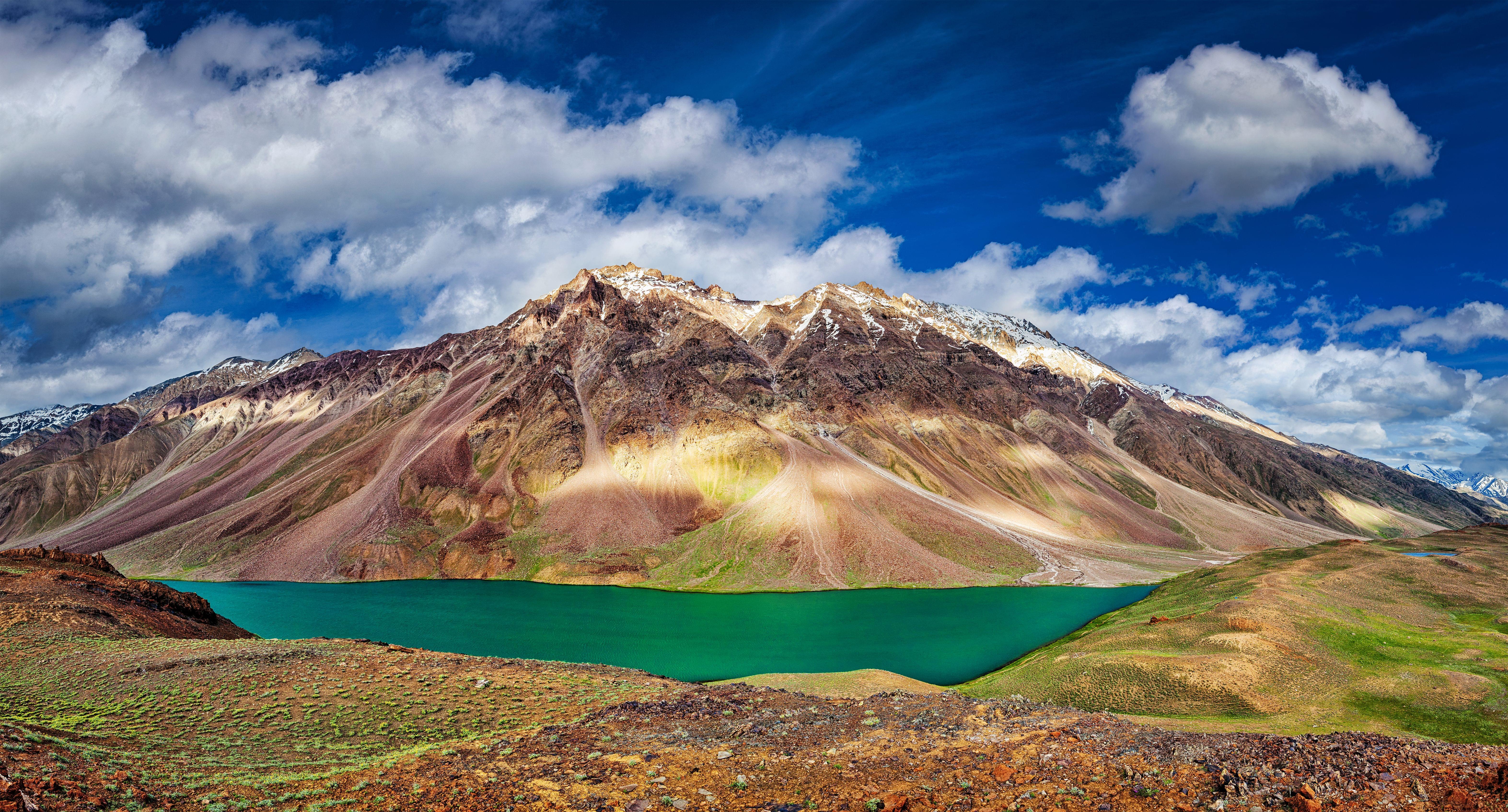
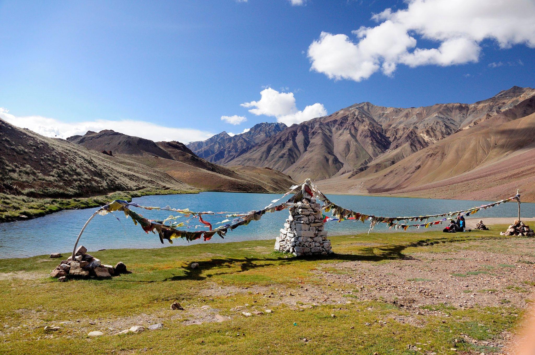
Drive to Chandratal alpine lake at an altitude of 14,100 ft.
Witness the splendor of turquoise chandratal lake reflecting the Himalayas surrounded by the greenest meadows.

Drive from Chandra Tal to Manali via Rohtang Pass
Have breakfast and travel through the Hampta Pass that connects Kullu Valley and the Lahaul and Spiti Valley.
Reach Manali where your chandratal trek ends, go home with a bag full of memories.
What to Pack for Chandratal Lake Trek?

Things to Carry
- Carry 35 to 40 liters of backpack
- Water bottles
- Eatables- biscuits, protein bars, glucose-based chocolates, cup noodles, dry fruits, and quick energy bites are some examples of foods.
- Shirts and pants for hiking
- Shoes for hiking that can be worn on any surface
- Flashflight and additional batteries
- Sunglasses
- Toiletry-toothpaste, tissues, soaps, cold coral, moisturizer, hand sanitizer, and anti-fungal cream.
- First aid kit
- Warm coat or sweater
- Lots of socks and gloves
- Raincoat—for rains
- Camera
Know Before You Go to Chandratal Lake Trek

Before the trek, see a doctor to determine your level of fitness and to get any other necessary checkups.
Trekking should be avoided during the monsoon season because it can be uncomfortable.
You must bring documents, such as identity proof and a fitness medical certificate from a licensed physician, in order to sign up for the Chandratal trek package.
Since there are no ATMs or UPI machines outside of Manali, keep cash on hand.
There wouldn't be a mobile phone network after Manali. You should therefore let your family and close friends know in advance.
The state's regulations must be followed.
Pay close attention to the trek guide's instructions.
Don't go on a nighttime hike.
Practice ventilation methods because the atmospheric pressure drops at such high altitudes, reducing the amount of oxygen that is inhaled.
Avoid using earphones because you need to be alert all the time about your surroundings while trekking.
Headaches, hypoxic conditions, vomiting, and a number of other medical conditions can all be brought on by a sudden drop in oxygen levels.
Take the necessary precautions and carry your medications to prevent these.
To save money, bring dry snacks and food from home.
As cold waves hit your head and face and cause your body temperature to drop, cover your head.
Rapid ascent will wear you out and increase your chance of being injured.
On the days of your trek, get 7-9 hours of sleep to avoid moving around restlessly, which will slow you down and make you uncomfortable.
Take a 50–60 liter backpack with you to carry everything you need.

Beyond Chandratal lake, you can either choose to leave via Rohtang Pass or you can go on an extended trek to Baralacha La.
- Trek from Chandratal lake to Tokpo Gongma: After enjoying your day beside the lake, you will trek to Tokpo Gongma in 6-7 hours. ‘Tokpo’ means River, ‘Gongma’ means Huge in the Tibetan language. After trekking about 12 kilometers, you will reach Tokpo Gongma campsite.
- Trek from Tokpo Gongma to Tokpo Yongma: You will trek to Tokpo Yongma river at 4650 meters above sea level. The terrain will be rocky, showcasing the beautiful looks of the snow-capped mighty Himalayas.
- Trek from Tokpo Yongma to Baralacha La: You will cross the stream to reach a comfortable plain path that leads to the south of Baralacha La, at 4950 meters. The trail will be covered by prayer flags and lead you towards the north. You will witness that the Baralacha La is a high pass that separates the Himalayas and the Lahul ranges. After spending some time, you will travel to Manali via road for the further journey.

By Air: You can use the Kullu-Manali Airport, which is 50 kilometers from Manali, located in Bhuntar. The airport is connected to flights from the airports of the corresponding cities, including Chandigarh, Delhi, and many others. You can take a bus or taxi from the airport to get to Manali.
By Train: The Jogindernagar railway station is where you can board a train and disembark. From there, you can take a bus or taxi to reach Manali at a distance of 145 kilometers.
By Bus: Manali is reachable from several well-known cities, including Delhi, Shimla, Leh, and many others. You can take any public or private bus to get there.

Summer Season: JuneDespite being summers, there are snow patches on grounds closer to Balu ka Ghera and beyond. The presence of snow doesn’t stop until you reach Hampta Pass, and you can likely find it again on the Lahul side. The depth of snow is quite high on both parts of the trail as daytime temperatures range between 15 °C and 20 °C while dropping between 1 °C and 5 °C.
Monsoon Season: July and AugustSnow starts to melt as July approaches and in August, most of it is gone. From mid-July onwards, grasslands turn vibrantly green with blooming pink flowers, marigolds, and blue poppies. The monsoon showers make wildflowers sprout in the entire green belt of the region, making it the best time to experience mother nature’s shades.
Autumn: SeptemberIt is the second best time to experience this trek as the whole region is lush and colorful. However, the temperatures drop slightly lower at night. As September approaches, early winter starts to come in.
General Trivia About Chandratal Lake Trek

In ancient times, the trail of Chandratal was used as a trading route for traders of Ladakh and Tibet, to visit Spiti and Kullu Valley.
Chandratal lake is considered sacred by Hindus as the legend says the lake is located at the place where the eldest of all the Pandavas, Yudhishthira, picked up Lord Indra’s chariot.
Hampta Pass has often been considered the Valley of Flowers in Himachal Pradesh during monsoons as meadows become lush with greenery and hundreds of wildflowers bloom.
Hampta Pass and Pin Bhaba Pass are often considered the same instead they are crossover treks with entirely different trails.
Why to Go for Chandratal Lake Trek?
You May Also Book

FAQ's for Chandratal Lake Trek
How much distance will I have to cover in the Chandratal trek?
You will be covering 35 kilometers in 5 days. It is approximately 7 kilometers per day to ascend and descend to cover the Chandratal trek.
Is trekking to chandratal lake safe?
Yes, trekking to chandratal lake is safe as the trail is a moderate level path which passes through lush green grasslands, meadows, valleys, and barren cold deserts. There are a few steep climbs but they can easily be crossed.
Will I find snow during the Chandratal lake trek?
There are high chances of you finding snow during the summer season in June near Hampta Pass and Lahaul. As the Monsoon approaches in July and August, snow starts to melt, limiting its presence in most places. During the month of September, the snow vanishes, and meadows shine in lush greenery.
Will I be allowed to camp near chandratal lake?
Yes, you can camp near the lake during pleasant weather. However, you can stay in a nearby accommodation for more comfort and ease.
Will I experience altitude sickness at such altitudes? If so, how do I protect myself?
Drinking water regularly can help the body stay balanced as you must not gain more than 1000 ft per day. The best way to eliminate any kind of altitude sickness is to get enough sleep. Pre-training builds a strong foundation of effective acclimatization and control of altitude-related problems.
What level of physical fitness should participants have before beginning the Chandratal lake Trek?
You must be in good physical condition to walk 35 kilometers with an average of 7 kilometers per day. You can attempt to walk for 8 to 10 kilometers per day while carrying 15 kg.
Is there a mobile network on the Chandratal trek?
Beyond Manali, there are no mobile networks, and the ones that do exist are catchable in Jobra only. Before commencing on the trek from Manali, you should notify your family and loved ones.
Can I offload during my Chandratal lake trek?
You can offload, but it will cost you more. Since it will take more work, it is advised that you carry backpacks by yourself. This is due to the fact that challenge and adventure are at the heart of a true trekking experience.
Treks in Ladakh & Kashmir